
Residents in the Leeward Islands and the British Virgin Islands are advised to closely monitor the progress of Hurricane Lee, which is expected to rapidly strengthen in the next 24 to 48 hours, according to the Department of Disaster Management (DDM).
The DDM reminded of the tropical cyclone alert currently in effect for these areas on Thursday morning, meaning that a tropical cyclone is in the vicinity with the potential to become a major hurricane. However, no watches or warnings are necessary at this time.
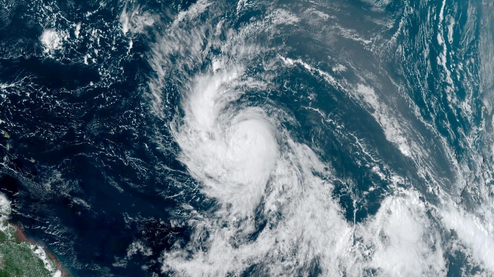
Hurricane Lee is expected to rapidly intensify in the warm waters of the Atlantic Ocean on Thursday and will likely become a major storm by early Friday, according to the National Hurricane Center.
The latest NHC forecast discussion said Lee’s maximum sustained winds could reach up to 150 mph, putting it at the higher end of the Category 4 range, nearing Category 5.
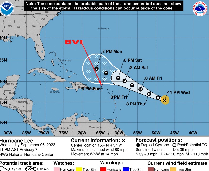
Lee is moving west-northwest at 12 mph and is expected to continue this general motion for the next few days. The storm’s track is uncertain beyond Saturday, but some models suggest it could turn northward and pose a threat to the US East Coast or Bermuda next week.
Hurricane Lee is located to the east of the islands and is expected to pass to the north of the area late Friday and Saturday as a major hurricane. Large swells are likely to affect coastal areas beginning on Friday. Other specific impacts with respect to winds and rainfall depend on the proximity of its eventual path.
The DDM urged residents to stay alert and prepared for any changes in the storm’s track or intensity. The agency also reminded residents to have their emergency plans and supplies ready and to follow any advice given by local officials. The DDM will continue to provide updates on Hurricane Lee as it approaches the region.